Triangulating an Octahedral Earth
We generate an octahedral quaternary triangular mesh (O-QTM) as follows:
Conceptually, we embed an octahedron in the earth, with two of its vertices at the poles and the other four on the equator, at 0°, 90°, 180° and 270° East longitude. To tessellate the octahedron, we raise the midpoint of each of its 12 edges to the sphere, forming 24 new geodesic edges, then connect each new vertex with its neighbors. This adds 24 new edges and creates a polyhedron with 32 triangular faces. This process is then repeated as many times as needed, each time multiplying faces by 4.
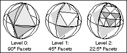
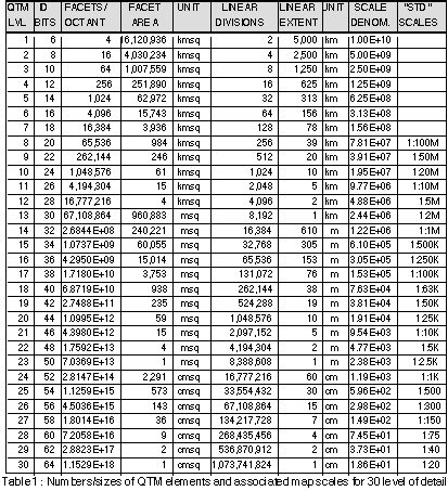
The octahedron's edges all span 90°, and with each subdivision this angle is cut in half. Although size and shape of facets do vary to a small degree, we can still tabulate their typical sizes and related properties: